
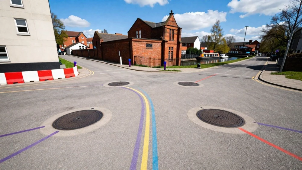
Utility Mapping Surveys
Get in TouchAt Coventry Surveys, we specialise in utility mapping surveys to help identify and locate underground utilities . Our services use advanced geophysical techniques and equipment to provide accurate information about gas, water, electricity and telecommunications lines, ensuring safety and efficiency in construction and excavation projects.
With our experienced team, you can trust us to deliver reliable surveys tailored to your specific needs. Contact us today for a detailed quote in .
How Much Does a Utility Mapping Survey Cost?
Utility mapping surveys typically cost between £200 to £500, depending on the size and complexity of the site. At Coventry Surveys, we base our pricing on factors such as survey area size, type of utilities involved, and required detection methods.
We use specialised equipment like ground-penetrating radar (GPR) and electromagnetic locators to accurately detect underground utilities such as water, gas, electric lines, and fibre-optic cables. The presence of non-standard utility materials or older pipelines may also affect pricing due to additional detection challenges.
Surveys spanning larger areas or with complex utility networks might incur higher costs due to the extended time and resources involved. Our team is skilled in meeting British Standard PAS 128 survey requirements, ensuring precision and reliability.
We offer competitive pricing tailored to your project needs and can provide an exact figure upon a detailed assessment.
What Are the Benefits of Utility Mapping Surveys?
Utility mapping surveys come with numerous benefits. These surveys employ various techniques like Ground Penetrating Radar (GPR) and Electromagnetic Location (EML) to accurately identify and map underground utilities.
Here are some key advantages:
Safety: Prevent accidental damage to underground utilities, reducing the risk of costly repairs and ensuring the protection of workers and the public.
Efficiency: Enable informed planning and decision-making in construction projects by providing detailed data on the location and depth of utilities, allowing for precise excavation strategies.
Cost-Effective: Minimise unexpected disruptions that could lead to project delays and additional expenses, thereby keeping projects within budget.
Compliance: Aid in meeting regulatory requirements by providing detailed utility information that aligns with industry standards and certifications such as PAS 128.
This comprehensive approach helps secure both project timelines and budgets. Get in touch with us to learn more about how our surveys can benefit your next project.
Book Utility Mapping Surveys Today
How Does a Utility Mapping Survey Work?
Our utility mapping survey process involves several steps to ensure accuracy and reliability:
Pre-Survey Consultation: We discuss your project requirements to understand the scope and objectives.
Site Visit: Our surveyors conduct an initial visit to assess site conditions.
Data Collection: Using ground-penetrating radar and electromagnetic location techniques, we gather utility data.
Data Analysis: We process the collected data to produce detailed maps of the utility layout.
Reporting: A report is generated, outlining the findings and recommendations.
Our approach ensures you receive precise data for your project.
What Regulations Apply to Utility Mapping Surveys?
Utility mapping surveys must comply with various UK regulations to ensure safety and accuracy. The PAS 128 standard is crucial, outlining the quality levels and methodologies for utility detection.
These include survey levels D, C, B and A, each offering varying degrees of detail and accuracy.
Survey level A, for instance, involves intrusive survey methods such as vacuum excavation to visually confirm the presence of utilities, while level B employs geophysical methods like Ground Penetrating Radar (GPR) for precise subsurface detection.
We also follow the guidelines of the Health and Safety Executive (HSE) to ensure safe surveying practices. Additionally, Coventry Surveys uses electromagnetic methods and adheres to the British Standard BS 5930 to classify and manage risks efficiently.
We provide utility mapping surveys that fully comply with necessary regulations and standards.
Why Choose Coventry Surveys for Utility Mapping Surveys?
Choosing Coventry Surveys for your utility mapping needs ensures you receive a service that combines expertise, advanced equipment and thorough knowledge. We accurately detect and map underground utilities using ground-penetrating radar (GPR) and electromagnetic locating technologies.
This allows us to identify gas lines, water pipes, electrical cables and other subsurface utilities, meeting British Standards PAS 128 for surveying accuracy, which is crucial for infrastructure development, construction projects and safety management.
Our experienced personnel are skilled in handling these technologies and interpreting the data, providing you with comprehensive reports that include depth, size and material type of utilities. Our surveys help in preventing costly utility strikes during excavation or drilling, which can cause severe delays and additional expenses.
We are committed to compliance and accuracy, ensuring your project's success. Partner with us to fully understand your site's underground challenges and make informed decisions with confidence.
Speak to a Utility Mapping Surveys Expert
Frequently Asked Questions
How do I maintain the accuracy of utility mapping data?
Regular surveys are recommended to keep data up-to-date, especially if site modifications occur. Maintaining accurate records helps manage future projects effectively.
What is included in the price of a utility mapping survey?
Our pricing includes initial consultations, on-site assessments, data collection, analysis, and a report. Any additional services are detailed in your quote.
How long does a utility mapping survey take?
Typically, surveys take one to three days, depending on site size and complexity. We aim for efficient data collection and processing to provide timely results.
Can I schedule a utility mapping survey at short notice?
We strive to accommodate urgent requests. Please contact us directly to discuss your project timeline and our availability.
Get a Free Quote for Utility Mapping Surveys
Contact Coventry Surveys today for a free, no-obligation quote on utility mapping surveys. Our expert team is ready to assist with your project needs.